Echuca Moama Torrumbarry flood modelling finalised
Published on 26 May 2020
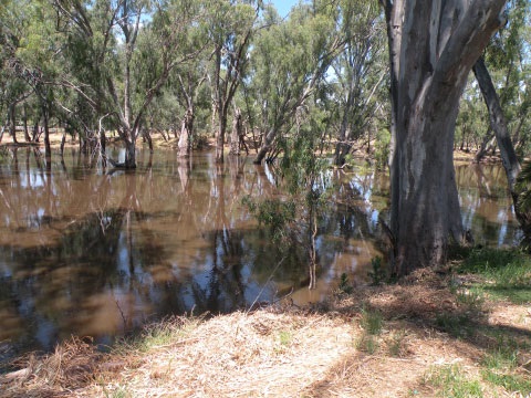
Campaspe Shire and Murray River councils have released flood modelling showing where flood waters went in three major flood events as part of the Echuca Moama Torrumbarry Flood Study.
Campaspe Shire Council Mayor, Cr Adrian Weston said after extensive community consultation, including interactive mapping and drop-in information sessions, we are confident the modelling now depicts the 1993, 2011 and 2016 flood events.
The Flood Study project started in November 2017, headed by representatives from Murray River Council, NSW Office of Environment and Heritage, North Central Catchment Management Authority and Campaspe Shire Council. A community reference group was also set up, to secure local knowledge to feed into the study.
“The mapping is now available on Council’s website and the community is encouraged to have a look and provide feedback as the final step of the modelling component of the project,” Cr Weston said.
The next step will be to complete design modelling, showing impacts of a range of events including 1:100 and 1:50 flood events for the same areas.
Murray River Council Mayor, Cr Chris Bilkey said the design modelling will show where waters are likely to flow should these flood events occur.
“This information will help in identifying areas at risk, depending on flood water levels, and will inform what infrastructure should be considered in the future to protect those areas,” Cr Bilkey said.
“It will also be used in reviewing flood level overlays for inclusion in planning schemes to control future urban development.”
Comments on the flood modelling close on Friday, 19 June with interactive mapping available from Campaspe Shire’s website, www.campaspe.vic.gov.au through the “open for comment” tab.
The comments received will be reviewed by the community reference group to determine if any final adjustments are needed to the modelling.